Gpx
Advertisement
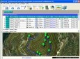
CacheMaps v.4. 1. 2008
CacheMaps retreives a variety of maps for your caches from the Internet. CacheMaps uses the Geocaching loc- or gpx-files as input. Directely from the Geocaching site or as exported from GSAK.CacheMaps v4 has been designed to be used next to GSAK.
Advertisement
JOSM v.4.399
Currently it supports loading stand alone GPX tracks and GPX track data from the OSM database as well as loading and editing existing nodes, ways, metadata tags and relations from the OSM database.
GeoGet v.2.6.2.663
GeoGet is a data manager. However, it is distributed without any data. The data content must be imported by you. You can import your PocketQuery GPX files, or you can save any Geocaching.
GPXtoPOI v.1.1.0.8
This program converts from GPX format to CSV format or vice versa. You can create waypoints in MapSource and then convert them to POI (CSV) files for download or sharing with others.
Grazer v.2 1
Grazer synchronizes GPX track files with images. It tells you where you took the image by analyzing when you took it. Grazer takes a GPX file and reads all elements of wptType, rteType and trkType from a specified file.
GPS2WorldWind v.1.0
With GPS2WorldWind you can: Create and display tracks, routes and waypoints Transfer waypoints, routes and tracks from/to your GPS device (see below 'Supported devices') Import Tracks, Waypoints and Routes from GPX, PCX5, OziExplorer or Google Map
CacheMagnet v.0.13
CacheMagnet is a free, open source geocaching waypoint management program. With CacheMagnet, you can read and display contents of .GPX or .LOC files, download waypoints to your GPSr, load .ZIP files from geocaching.
GPSResults v.6 96
The GPSResults program can be used to calculate and evaluate the track-velocities from measured GPS-data. First of all the data (trackpoints) have to be read from your GPS, transferred to your computer, and saved as gpx-file.
GPS Track Viewer v.1.1
GPS Track Viewer makes it easier to import and display track data from GPS devices. It is designed to be feature-rich, elegant and fast and supports different formats, e.g. TCX and GPX. You can browse through your data easily, viewing time, distance,
GPXFlash v.1.4.3
GPXFlash is a tiny GPX-File parser, also shows the contained GPS-Tracks on a Google Map using the Google Maps Flash-API and draws Height-Profiles of the Tracks.Requirements: * Adobe
Advanced Points Manager v.1.0
The Advanced points manager imports points to AutoCAD drawing from different data sources. OLE-DB database, SHP (ESRI shape file), GPX (GPS eXchange format), KML (Keyhole Markup Language), GML (Geography Markup Language), TXT, CSV.